
📊 Full opportunity report: The Eye Over The City: How Wide-Area Motion Imagery Works — And Where It Goes Blind on ThorstenMeyerAI.com — validation score, market gap, and execution plan.
TL;DR
Wide-Area Motion Imagery (WAMI) enables city-wide surveillance by capturing and archiving real-time, high-resolution imagery of entire urban areas. Its capabilities are transforming military, security, and emergency response operations, but it faces technical and governance challenges.
Wide-Area Motion Imagery (WAMI) systems now allow analysts to monitor entire cities in real-time, recording every movement across several square kilometers. This technological advancement provides extensive surveillance capabilities, with implications for military, security, and emergency response operations.
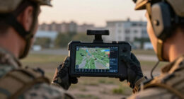
WAMI systems utilize an array of cameras that produce a single, gigapixel-scale image, capturing vast urban areas from high altitudes. For example, DARPA’s ARGUS-IS employs 368 cameras to generate detailed imagery, capable of resolving objects as small as six inches from approximately 17,500 feet above ground. These systems record continuously, enabling analysts to rewind and scrutinize specific events or movements long after they occur.
The processing pipeline involves stabilizing the image, detecting moving objects, tracking their movement across frames, and archiving the data for later review. Due to the enormous data rates, real-time human monitoring is impractical, making automation and AI essential components of the system. WAMI sensors are mounted on various platforms, including aircraft, drones, and tethered aerostats, expanding their operational flexibility.
Historically, WAMI technology emerged in the early 2000s, transitioning from experimental programs to operational deployment by the US military in Iraq and Afghanistan. Its primary mission is network discovery—tracing back from an incident to identify the actors involved—complementing other sensors like radar and full-motion video to create layered, persistent surveillance networks.
The eye over the city: how Wide-Area Motion Imagery works — and where it goes blind
A normal drone sees through a soda straw. WAMI watches an entire city at once, tracks every mover, and records it all for forensic rewind. Immense reach — with hard limits that make radar and AI its necessary partners.
- City-scale motion, fine detail
- Forensic rewind
- Cloud / smoke / dark degrade it
- Needs a platform loitering overhead
sensing
+ AI
- Sees through cloud & total dark
- Tasked over denied airspace
- Persistent, wide-area from orbit
- Sovereign · on-prem · air-gap
The same archive that traces a bomber to a safe house can trace anyone home — retroactively, without prior suspicion. Baltimore’s secret 2016 deployment led to a 2021 federal ruling that persistent aerial tracking violated the Fourth Amendment. The security value is real; so is the mass-surveillance risk. Who owns the sensor, the archive, and the AI is the accountability question.
WAMI’s power is the archive and the AI reading it; its weakness is weather, airspace, and oversight. The mature posture isn’t optical-vs-radar or capability-vs-liberty — it’s layered sensing (optical WAMI + all-weather SAR), AI-enabled exploitation, and sovereign, auditable control of the whole chain. WAMI shows what a persistent eye can do with clear skies and owned airspace; for the cloud, the night, and the denied area, the radar layer is where the resilient coverage lives.
Impacts of WAMI on Security and Surveillance
WAMI’s ability to observe large areas continuously and archive detailed imagery has influenced surveillance practices, enabling detailed analysis of urban movements. This capability supports military intelligence, border security, and emergency response efforts, but it also raises questions regarding privacy and oversight. The reliance on AI for data processing highlights the importance of establishing appropriate governance and ethical standards in deployment.
high resolution wide-area surveillance camera
As an affiliate, we earn on qualifying purchases.
As an affiliate, we earn on qualifying purchases.
Evolution and Deployment of WAMI Technologies
WAMI originated in early 2000s research at Lawrence Livermore National Laboratory, evolving into systems like DARPA’s ARGUS-IS and the US Air Force’s Gorgon Stare, deployed on drones and aircraft. Over the past two decades, the technology has become smaller and more versatile, transitioning from experimental platforms to operational tools used in military and civilian contexts. Its development reflects a broader trend toward persistent, layered surveillance systems.
“WAMI systems provide a city-wide, real-time forensic capability that can support various security and operational needs.”
— Thorsten Meyer, AI and Surveillance Expert
gigapixel city monitoring system
As an affiliate, we earn on qualifying purchases.
As an affiliate, we earn on qualifying purchases.
Technical and Governance Challenges in WAMI Deployment
While WAMI’s technical capabilities are well-documented, questions remain about its scalability, integration with other sensors, and the legal and ethical frameworks governing its use. The extent of its deployment in civilian contexts and oversight mechanisms is still evolving, with ongoing court cases and policy debates.
drone mounted WAMI camera system
As an affiliate, we earn on qualifying purchases.
As an affiliate, we earn on qualifying purchases.
Future Developments and Integration of WAMI Systems
Advances in AI and sensor fusion are expected to enhance WAMI’s automation, accuracy, and operational range. Increasing integration with radar systems like SAR will address current limitations, such as weather dependence and contested airspace. Regulatory frameworks and oversight are likely to evolve alongside technological progress, shaping the future of persistent surveillance.
AI-powered motion detection security camera
As an affiliate, we earn on qualifying purchases.
As an affiliate, we earn on qualifying purchases.
Key Questions
How does WAMI differ from traditional surveillance cameras?
WAMI captures city-wide, high-resolution imagery in a single frame, covering several square kilometers, unlike conventional cameras that focus on narrow fields of view.
What are the main limitations of WAMI technology?
WAMI relies on optical sensors, which are affected by weather, darkness, and obstructions. It also requires platforms to loiter overhead, which can be contested or expensive.
How is WAMI integrated with other sensors?
WAMI is often paired with radar systems like SAR to provide all-weather, deep-denied coverage, creating layered sensing capabilities.
What are the privacy concerns associated with WAMI?
Its ability to archive and review urban movements raises questions about surveillance overreach and civil liberties, prompting ongoing legal and policy debates.
What is the future of WAMI technology?
Future developments will likely focus on AI-driven automation, better integration with other sensors, and addressing legal frameworks for ethical use.
Source: ThorstenMeyerAI.com